
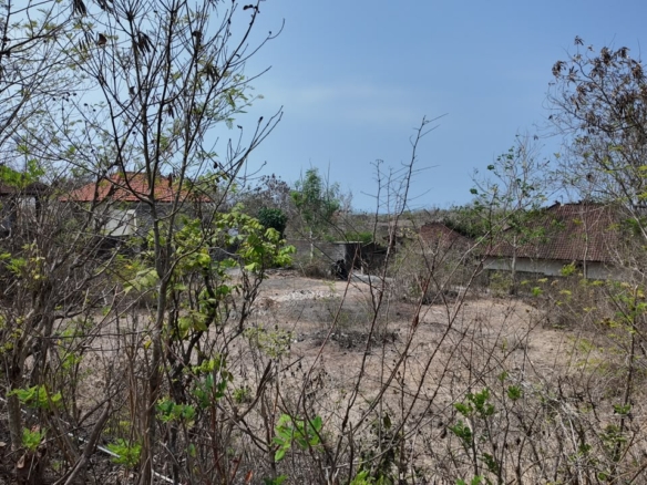
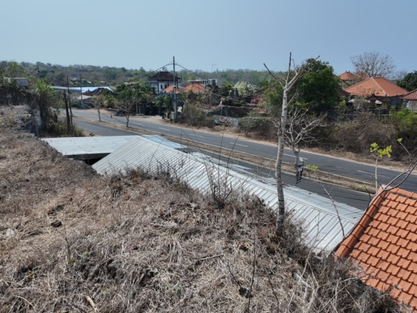
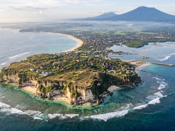
The sixty-are freehold plot we list in Balangan has a 120-metre frontage and runs about fifty metres deep. Put that same plot on the sand and the national minimum coastal setback — one hundred metres measured inland from the highest tide line — would cover it twice over, with nothing left to build on. It sits five minutes from Balangan Beach instead, which is the entire reason it is developable.
That arithmetic is what beachfront means in Bali. The word describes a view and a short walk; the law describes a strip you may not build in, measured from a line that moves twice a day. Here is where that line sits, who draws it, what the unbuildable strip costs per metre of frontage at our own asking prices, and what happens to people who build in it anyway.
The line the law draws, and who draws it
Presidential Regulation 51/2016 on coastal boundary lines (promulgated 19 June 2016, State Gazette 113/2016) defines two things the market treats as one. Article 1(6) defines the beach itself: “Pantai adalah daerah antara muka air surut terendah dengan muka air pasang tertinggi” — the area between the lowest low water and the highest high tide. That is an intertidal zone, not a parcel, and nothing in a seller’s folder describes it.
Article 1(2) then defines the coastal boundary, sempadan pantai: land along the shore whose width is proportional to the form and physical condition of the coast, “minimal 100 (seratus) meter dari titik pasang tertinggi ke arah darat” — a minimum of one hundred metres from the highest tide line landward.
Two consequences get lost in translation. The hundred metres is a floor, not a figure: the width is proportional to the coast, so a calculation can legitimately produce more. And it is measured from a tidal line, not from a road, a fence or the boundary drawn on the certificate — which document actually proves where that boundary runs is the subject of our Bali land certificate check.
Timing is not vague either. Article 25 requires regional governments “wajib menetapkan batas sempadan pantai paling lama 5 (lima) tahun” from promulgation — a deadline that fell on 19 June 2021 — and the instrument is the regional spatial plan: Article 3 spells that out for Jakarta, where the Governor sets the boundary and it is established in the provincial spatial-plan Perda. For Bali that plan is Perda Provinsi Bali 2/2023, the Bali Spatial Plan 2023–2043.
The width is calculated, not chosen. Article 6(1) ties the calculation to the topography, biophysical and hydro-oceanographic character of the coast and to economic and cultural needs. Article 6(2) sets the six grounds:
| Article 6(2) | Ground for the boundary |
|---|---|
| a | Protection against earthquake and/or tsunami |
| b | Protection of the shore from erosion or abrasion |
| c | Protection of man-made coastal assets from storms, flooding and other natural disasters |
| d | Protection of coastal ecosystems — wetlands, mangrove, coral reef, seagrass, dunes, estuaries, deltas |
| e | Regulation of public access |
| f | Provision for water and waste channels |
There is one route to a narrower strip, and it is not a negotiation. Article 21 allows the boundary on disaster-prone coast to be set below the calculated result “dengan ketentuan wajib menerapkan pedoman bangunan (building code) bencana” — on condition a disaster building code is applied. Less than a hundred metres therefore exists in Indonesian law, attached to engineering obligations rather than to a developer’s preference. Article 26 keeps earlier implementing rules alive where they do not contradict the regulation, which is why older regency figures still circulate.
What the strip costs, at our own asking prices
On a coastal plot the setback is the most expensive land on the parcel and the part you cannot build on. Our live catalogue prices the proximity gradient directly; all five plots below are freehold (SHM), so the comparison is like for like.
| Plot | Size | Per are (IDR) | Per are (USD) | Whole plot (IDR) |
|---|---|---|---|---|
| Melasti, Ungasan — clifftop above Pantai Melasti | 53 are | 792,000,000 | 43,666 | 41.98 bn |
| Balangan, Jimbaran — 5 min to the beach | 60 are | 625,000,000 | 34,458 | 37.50 bn |
| Kutuh, Jalan Melasti II | 97 are | 325,000,000 | 17,918 | 31.53 bn |
| Nusa Dua | 100 are | 260,000,000 | 14,335 | 26.00 bn |
| Kelecung, Selemadeg, Tabanan — at Pantai Kelecung | 40 are | 95,000,000 | 5,238 | 3.80 bn |
Converted at the Bank Indonesia JISDOR reference rate of Rp 18,138 per US dollar for 30 October 2026, used throughout. These are the plots live on this site at the time of writing, not a market average; the costs that stack on top of an asking price are in what a Bali land plot actually costs per are.
Now price the strip itself. One are is one hundred square metres, so every metre of shoreline frontage carries exactly one are of land for each hundred metres of depth. At Balangan’s rate that is Rp 625,000,000 — about US$34,500 — per metre of frontage sitting inside the setback; at Melasti’s rate, Rp 792,000,000, about US$43,700. A modest forty-metre frontage on genuinely beachfront land locks up Rp 25 to Rp 31.7 billion of ground you may not build on. The same ocean off the west coast at Kelecung costs Rp 95,000,000 per are — a sixth of Balangan, a fifteenth of Melasti — which is the clearest single argument for looking beyond the Bukit.
What “beachfront” actually describes in a listing
Three different things travel under the word, and they are not interchangeable.
- Clifftop above a beach. The Bukit pattern — our 53-are freehold at Melasti. The cliff does the work of the setback: you look down on sand you do not own, and the buildable area starts well back from the edge.
- Near-beach. A few minutes’ walk or drive, like the 60-are freehold at Balangan, whose data sheet says five minutes to the beach. This is where tourism zoning and usable depth coexist.
- Beach access. A right of way, not frontage — and worth reading against Article 4(c), which makes “alokasi ruang untuk akses publik melewati pantai”, space for public access along the beach, one of the boundary’s purposes, with public access repeated as a criterion at Article 6(2)(e). A scheme whose selling point is fencing the shore argues against the instrument that defines its own setback.
We do not list any plot as beachfront, and nothing in our catalogue is titled land inside the coastal boundary. The two above are the closest, and both are priced as what they are. Every plot in our land for sale listings names its district, which is where the check below starts.
The overlays that still apply landward of the line
Clearing the setback does not make a coastal plot buildable; it only makes the rest of the stack relevant. Perda Bali 2/2023 caps building height at 15 metres above ground level province-wide at Pasal 100(2), with an exception list at 100(4) — aviation, worship, defence, disaster, telecoms, power, hospitals — none of which is a villa. In a tourism zone, Pasal 95 sets height at 15 metres, coverage at up to 50% and parking from 20% of floor area. At parcel level the answer comes from the detailed plan: for everything in Kuta Selatan — Balangan, Melasti, Kutuh, Nusa Dua — that is Perbup Badung 59/2021. How to read your own subzone for nothing, and which permission turns a zone into a right to build, is in Bali land zoning explained. The sequence is the same on the coast as inland: establish conformity for your intended use under Ministerial Regulation ATR/BPN 13/2021 first, pay second — and settle the ownership structure before either, as set out in can foreigners own land in Bali.
What building in the strip costs
Law 27/2007 on the management of coastal zones and small islands prohibits twelve activities at Article 35. Eleven concern reefs, mangrove, seagrass and extraction. The twelfth, Article 35(l), catches construction: “melakukan pembangunan fisik yang menimbulkan kerusakan lingkungan dan/atau merugikan Masyarakat sekitarnya” — physical construction that causes environmental damage and/or harms the surrounding community.
The sanction is criminal. Article 73(1)(g) carries two to ten years’ imprisonment and a fine of Rp 2,000,000,000 to Rp 10,000,000,000 — roughly US$110,000 to US$550,000 — where the construction is deliberate; Article 73(2) covers damage through negligence at up to five years and up to Rp 1,000,000,000, about US$55,000.
Read the floor of that range against the table above. The minimum fine is Rp 2 billion; the whole forty-are coastal freehold at Kelecung is Rp 3.8 billion. On that plot the smallest fine the article allows is more than half the purchase price, before any demolition or restoration order.
The numbers we don’t quote
- Badung’s own established setback for a named beach. The Article 25 deadline passed on 19 June 2021, but we could not read Badung’s determination in a primary source, so we publish no metre figure for Balangan, Melasti or Nusa Dua. Ask the regency one-stop office in writing, for the parcel.
- How much of a specific plot falls inside the strip. That is a survey against the highest tide line on that stretch of coast — not a desk answer, and anyone producing one from a map is guessing.
- The permit for anything seaward of the line. Works below the highest tide line sit in marine space and are licensed separately, as conformity of marine spatial use (KKPRL). We could not read the operative article in a primary source, so we cite none — ask the Ministry of Marine Affairs and Fisheries.
- Coastal abrasion rates for south Bali. Widely quoted, rarely sourced. The rate matters to Article 6(2)(b), so we name the ground rather than invent the number.
- Cliff-edge setback distances. As in our zoning piece: we could not locate them in an article of the provincial Perda, so the figure stays out until we can cite it.
What survives is a method you can apply before paying for a view. Establish where the highest tide line runs, ask the regency in writing for the established coastal boundary at that parcel, subtract the strip from the buildable area rather than from the price, then run the ordinary zoning and conformity sequence on what is left. A plot marketed as beachfront that cannot survive that subtraction is not cheap land with a problem — it is a view with no building plot behind it.
Read next
- Bali land taxes: who pays what, and under which article — BPHTB, PPh and PBB, and which side of the deal carries each.
- Where to buy land in Bali: the southern areas compared — how the coastal districts differ on price, access and what is actually available.
More on buying land here: the Bali land guides hub and the catalogue of land for sale in Bali.

Join The Discussion